
Heading north from Montero in the night there was a stream of bush fires in the forested areas to the west.


We drove on into the night until we came to the ferry at the Rio Grande where we camped on the grass by the village at the ferry.

Panorama of the village at night

Interior of the village church


Morning panoramic view of the shores of the Rio Grande

The sun instead of setting red with smoke rose an iridescent shade of green


Nesting bird with young in a next made of its own cement

Our camp site by the river


Panorama of the ferry terminal


The ferry was transported by men standing in the water and in the ferry with poles


On the other side was a wasteland flood plain which Teresa also said had been turned into a desertified area through unsustainable land use. The Google map satellite image bleow shows the area is now extensively covered with agribusiness development.


Google maps image of the Rio Grande crossing 2012 showing changes in land use
with extensive agribusiness development.
with extensive agribusiness development.


The arid village around Comunidad Madricetas in the dry season.


Panorama of the dry open grassland

The second village of El Fortin - Libertad

Panorama of the cross roads at the village center


Circular panorama of the open pasture on the road to the north
(click to the left of the image to enlarge)


Forest island on the savannah

Brahmin cattle beside a water hole in a pasture block


Panorama of the terrain
As of 2012, virtually all of the region from the Rio Grande crossing to San Ramon which we are heading to has been developed in extensive agribusiness. Notable are also a series of circular developments each centered on a small community often referred to as "pie" communities.

Google maps satellite view of the region from the Rio Grande to San Ramon showing both extensive
agribusiness development and a number of circular "pie" communities (click left of the image to enlarge).
agribusiness development and a number of circular "pie" communities (click left of the image to enlarge).
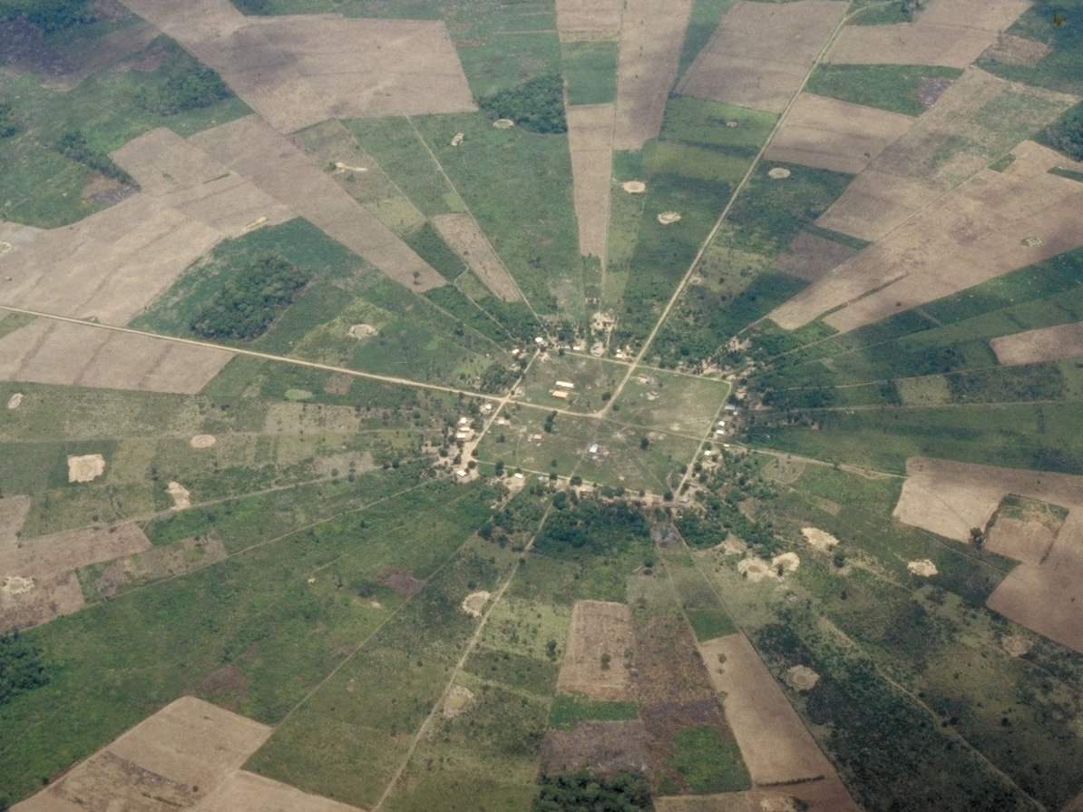
Recent satellite view of one of the "pie" communities

Coming into San Ramon


Recent image of the statue of the founders of San Ramon with garden improvements since 1999


Centre of San Ramon


A quizzical brass band was practicing in the town

Sounds of the band in San Ramon (mp3)

Yet another logging truck

Panoramas of the road north and another blue cemetery


We came upon the almost deserted small community of Yatou looking distinctly derelict in 1999, but rather more spruced up in the two later internet images dating from 2005.


More recent 2005 views of Yatou showing effects of development


Burned out forest north of Yatou


More fires beside the road unattended

Logging trucks and timber saw mills abounded


More timber mills, probably a dying breed, as the native timber becomes exhausted


Large scale soya plantation

How many more logging trucks can we have before the forest is extinguished?


Washing the village clothes in the river


Panorama of burned scrub by a sawmill


We reached an area where fire had run through the forest burning everything in its path. It was hard to tell if this was a land clearing operation or a wild fire out of control.


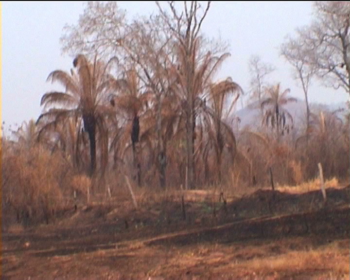

Panorama of the burned land as far as the eye could see


Significantly this ranch house seems to have conveniently escaped the destruction
suggesting the whole process was intentional


Cacti and flowering tress in the dry tropical forest


No comments:
Post a Comment