
Discarded rain forest logs scattered along the road side
After leaving the nature reserve, we were now on the last leg of our journey traveling south again back towards La Paz in the late afternoon.


We stopped briefly at yet another bush-burning site shrouded with the red glow of the setting sun.


Kids watching as we film the local burning

Passing by a number of local logging operations, such as "Empresa Madiera Sata".


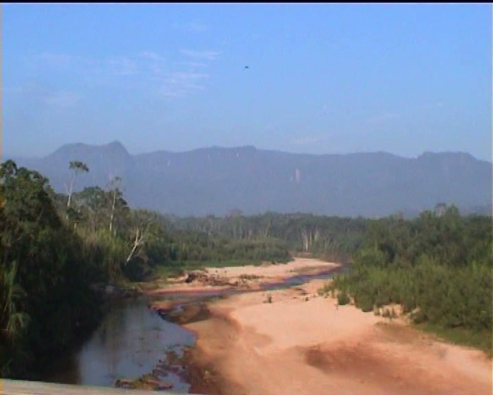
One of the many river crossings


The Andean foothills finally come into view just before Yucuma
Eventually we arrived at Yucuma, where we pulled in at a roadside motel-like hostal for the night, just in sight of the first views of the Andean foothills we were going to climb the next day. Yucuma was a two-horse truck-stop road town with a shanty town market and little else to recommend it.

Three panoramas of Yucuma and the Andean foothills


The diversity of night moths caught in the glare of the lights at Yucuma


Green parrots in the kitchen


The kitchen in the morning

Looking out the back to the bungalow guest rooms


Breakfast in the kitchen


After breakfast, we set off on what roved to become a full days arduous travel on precipitous hill roads, which climbed ever more steeply eventually ascending the notorious "death road" in the middle of a moonless night.

The short drive from Yucuma to the first Andean foothills

As soon as we reached the national park on the foothills we could see there was more forest burning right on the steepest slopes.

Forest burning in the national park

It is hard to understand what the purpose of such a burn could be.


The fires are all clearly deliberately lit in an elaborate pattern

Climbing a little hgher we began to get the first views over the Andean foothills.

First Andean panorama


Panoramic view


Full scale panormaic view


From here the road continued to wind ever higher with further sweeping views of the hill country.

Hill panorama


Hill panorama

Yet another burned out hill plot beside the road

Hill panorama

The road ceased to be paved and now became a dusty shingled affair.

Hill panorama with the higher mountains in the background


Hill panorama

Relentless logging and timber activity


Flowers and insects in the lower foothills


The road now became rough and rutted with frequent large pools and muddy puddles.

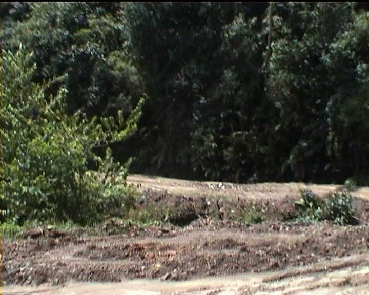


More small-scale burning for hillside plots

Eventually we stopped in at a small hill town Caranavi for lunch at a hotel above the main street.
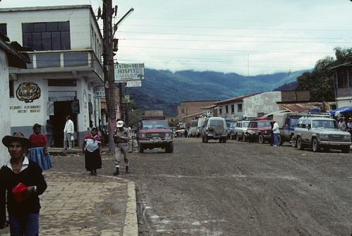
Flickr image of the main street of the town

Hilltop restaurant and hotel with a swimming pool


The road remained very rough and narrow and began to enter a series of precipitous ravines winding its way uphill on the edge of a river course.


Generally in Bolivia you drive on the right with a left-hand drive vehicle, but on these steep precipitous roads you suddenly come upon a sign saying "drive on the left" so that the driver can look out the side window and literally see if they are falling off the edge. The trouble of course is the confusion if the oncoming driver didn;t see the sign and tries to pass on the same side!


How narrow can a ravine get?

A rough-hewn tunnel ...

... with a sharp corner inside!
Here the road was literally only wide enough for a single vehicle to pass yet we met streams of heavy trucks piled up waiting to pass the other way.


A large hill forest clearing


A little road side village on the dusty road


The fist alpine coca fields in view

Twards the end of the afternoon, we came to this small road-side shanty town.


We were now beginning to get to the lower parts of the Yungas transition area between the lower foothills and the Andean peaks.


Another small fire in the night

Just as the light faded, the first of the high Andean peaks came into view.


We stopped briefly at this small road-side town in the Yungas before heading on to La Paz. At this point there were a series of newly constructed bridges for the new Yungas road and it proved very difficult to find the entrance to the old Yungas road with was still being used. After a few false starts, we eventually began to wind steeply up another small dirt road which climbed on and on endlessly in the night.
We had chosen the evening because Teresa knew you can travel up only at night and down only in the day to avoid any head on collisions or people falling off the road trying to pass one another.
I had wanted to stop the vehicle and step outside half way up when water came cascading over us and I realized we were under a waterfall, but Teresa snapped "No don't do that! This is the most dangerous place on the most dangerous road in the world and if you step out here you will fall a couple of thousand metres to your death!"
This whetted my appetite, so next day I resolved to take a minibus down the same road in the day - the subject of the next chapter on the Yungas Death Road.

No comments:
Post a Comment