 Map of the journey.
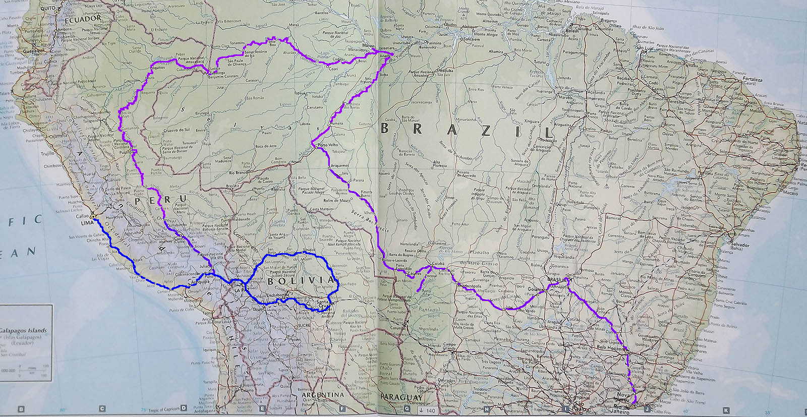
The blog covers the Amazonian section of a longer journey.
Initially we arrived in Lima and traveled south to La Paz where we hired a Land Cruiser and drove a circular route through the Bolivian dry tropical forest during the burning season as well as two trips to the Yungas to look at ecological transition zones.
We then came back to Puno stopping on Isla del Sol and then began the journey in the blog from Puno to Cusco and then to Ollantaytambo, Machu Picchu and over the Cordillera Oriental to Quillabamba following the Urubamba much of the way.
We then went down the Urubamba through the Pongo de Manique to Sepaua, and the Ucayali to Atalaya and Pucallpa. From there we went to Iquitos via the Pacaya-Samiria National reserve. We then traveled down the Amazon through Leticia and Banjamin Constant to Manaus.
At this point we went up the Rio Madiera to Port Velho and by bus to Cuiaba where we took the Transpantaneira through Pocone part way to Porto Jofre on the Pantanal. We then traveled by bus through Brazilia to Rio.
No comments:
Post a Comment